map / The Kingdom of Ireland, 1792
 map / The Kingdom of Ireland, 1792
 map / The Kingdom of Ireland, 1792
 map / The Kingdom of Ireland, 1792
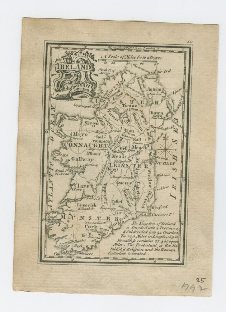
Map of Ireland, probably 18th century. Titled ‘Ireland. The Kingdom of Ireland is divided into 4 Provinces and subdivided into 32 Counties. Tis 275 miles in Length, 169 in Breadth and contains 27, 487 square miles. The Protestant is the established religion and the Roman Catholick tolerated’. Numbered in corner 25. Dated 1792.;
The Kingdom of Ireland, 1792
Object Number:
HH:2013.335 (temp)
Institution:
NMI
Date:
1792
Collections:
Subjects: