map / A New Map of Ireland, 1716
 map / A New Map of Ireland, 1716
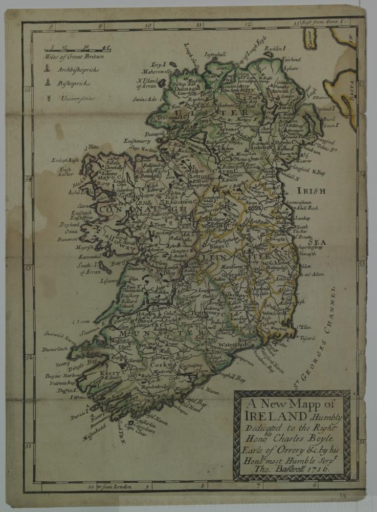
Map of Ireland, 18th century. Titled ‘A New Map of Ireland, Humbly Dedicated to the Right Honorable Charles Boyle, Earle of Orrery & c. by his Honorable most Humble Servant Thomas Baknell 1716’. Showing Archbishopricks, Bishopricks and Universities. Numbered in corner 15. Coloured.;
A New Map of Ireland, 1716
Object Number:
HH:2013.340 (temp)
Institution:
NMI
Date:
17161800
Collections:
Subjects: