map / A New and Accurate Map of Ireland
 map / A New and Accurate Map of Ireland
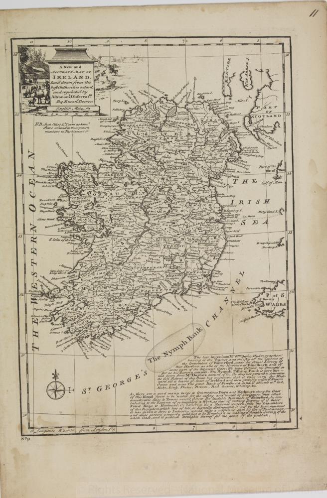
Map of Ireland, late 18th or early 19th century. Titled ‘A New and Accurate Map of Ireland, laid down by the best Authorities extant, and regulated by Astromon Observat, by Eman Bowen’. Text beneath reads The late Ingenious Mr William Doyle, Hydrographer, having at the request and chiefly at the expense of the Corporation of Waterford, made an actual survey of that Harbour, as also of the Harbour of Rineshark and of some part of the adjacent coast. We have followed his draft so far as his survey extends. The Nymph Fishing Bank is here also – laid down from Mr Doyle’s account of it. He does not pretned to determine the full extent of this bank but conjectures that it runs very far Westward till it leaves the coast of Ireland and then probably crosses the Western Ocean and joins the great Bank of Newfoundland. It abounds with cod, Hake, Ling, Skate, Bream, Red Gurnet, Whiting etc. As there are a good many large and commodious bays and harbours along the coast of this island twere to be wished for the safety and benefit of navigation, that other considerable cities and towns would follow the laudible example of Waterford, by contributing to the expense of so necessary a work as that of making surveys of the most noted bays and harbours: or rather (as tis a national concern) that the legislature of this Kingdom, which has of late so signally distinguished itself by the Incouragement it has given to Arts and Industry, would raise a sufficient summ by Act of Parliament and cause persons properly qualified to be Employed in making a complete survey of the whole coast, and to publish Draughts thereof for the good of the publick.
Numbered in corner 17.;
A New and Accurate Map of Ireland
Object Number:
HH:2013.354 (temp)
Institution:
NMI
Date:
17501850
Collections:
Subjects: