advertisement / The Historical Atlas of Ireland, c.1862
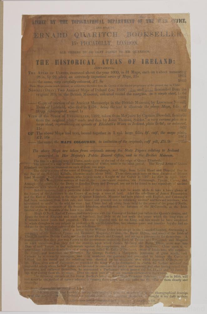 advertisement / The Historical Atlas of Ireland, c.1862
Printed notice, advertising the publication of ‘The Historical Atlas of Ireland’. Containing The Atlas of Ulster, executed in 1609, in 31 maps. Two ancient maps of Ireland circa 1566. Copy of a portion of an ancient manuscript in the British Museum by Dean Laurence Nowell, being the text to illustrate the above maps.
A View of the Siege of Enniskillen, 1592.
Maps taken from originals among the State papers relating to Ireland preserved in Her Majesty’s Public Record Office, and in the British Museum.
Listed by the Topographical Department of the War Office and sold by Bernard Quaritch, Bookseller, 15 Piccadilly, London. Circa 1862.;
The Historical Atlas of Ireland, c.1862
Object Number:
HH:2013.403 (temp)
Institution:
NMI
Date:
18621880
Creator:
Place of production:
England
Collections:
Subjects: