map / A Topographical and Historical Map of Ancient Ireland
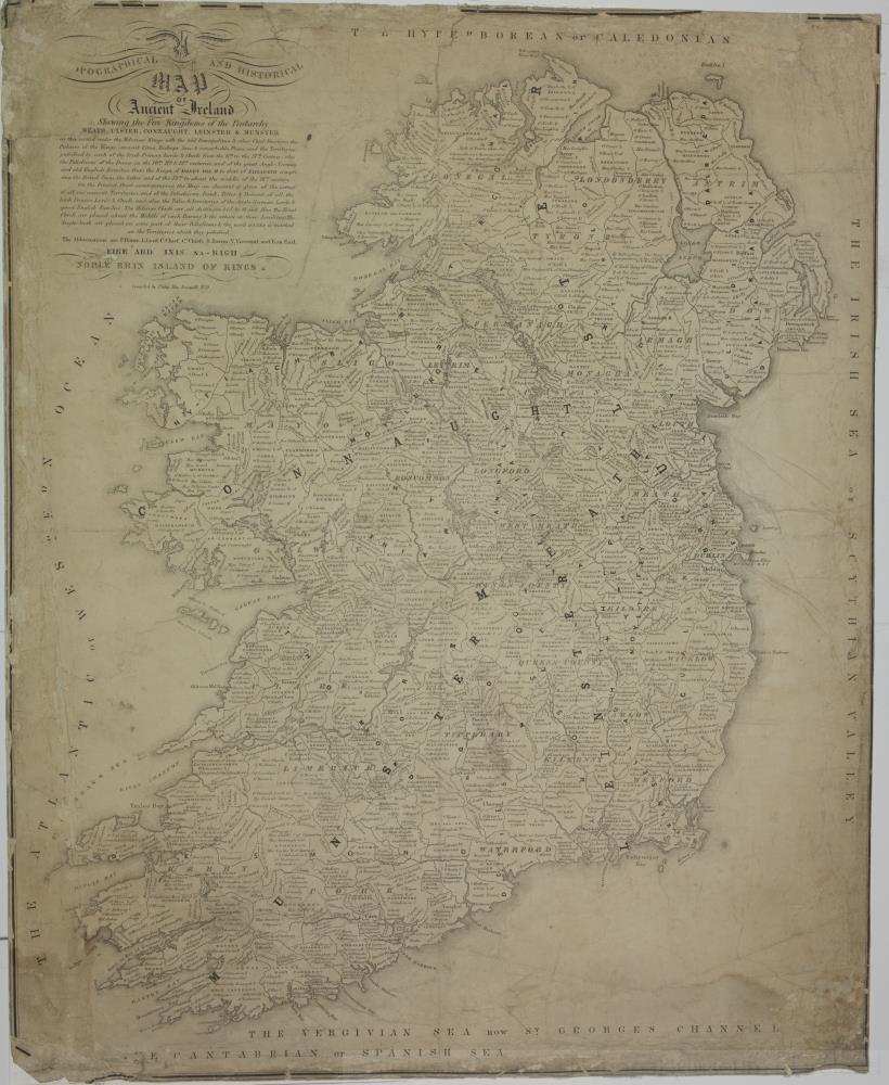 map / A Topographical and Historical Map of Ancient Ireland
Map of Ireland, late 18th or early 19th century.
Titled ‘A Topographical and Historical Map of Ancient Ireland’. Shewing the Five Kingdoms of the Pentarchy Meath, Ulster, Connaught, Leinster and Munster, as tey existed under the Milesian Kings with the old Principalities and other Chief Divisions, the places of the Kings, ancient cities, Bishops and Sees, and remarkable places, and the territories possessed by each of the Irish Princes, Lords and Chiefs, from the 11th to th 17th century, also possessions of the Danes in the 10th, 11th and 12th centuries, and of the great Anglo-Norman and Old English families, from the reign of Henry II to that of Elizabeth, comprising the period of the latter end of the 12th to about the middle of the 16th century. On the printed sheet accompanying the map an account is given of the extent of all the ancient territories, and of the possessions, rank, titles and descent of all the Princes, Lords and Chiefs, and also the titles and territories of the Anglo Norman Lords and Old English families. The Milesian Chiefs are all distinguished by O and Mac. The Heads are placed about the middle of each Barony and the others on their Localities. The Anglo-Irish are placed on some part of their possessions and the word Danes is marked on the territories which they possessed. Abbreviations are P. Prince, L. Lord, C. Chief, Cs Chiefs, B. Baron, V. Viscount and E an Earl.
Eire ard inis na Righ, Noble Erin, Island of Kings.
Compiled by Philip MacDermott M.D.;
A Topographical and Historical Map of Ancient Ireland
Object Number:
HH:2013.390 (temp)
Institution:
NMI
Date:
17501830
Creator:
MacDermott, Philip
Place of production:
Great Britain
Collections:
Subjects: