map / Ireland, 1712
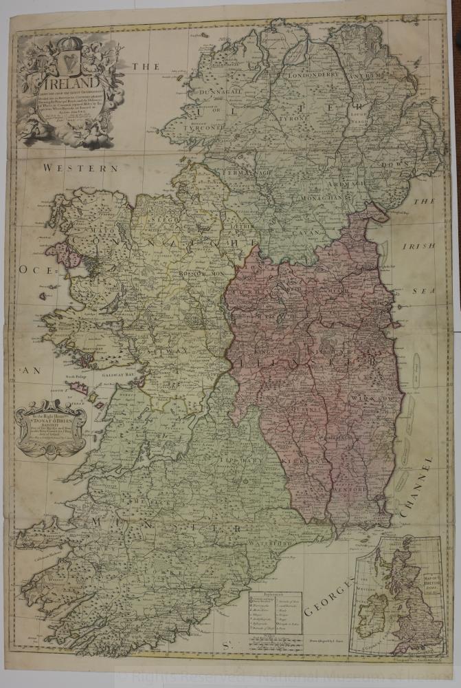 map / Ireland, 1712
Map of Ireland, early 18th century. Titled ‘Ireland’, corrected from the latest observations, divided into its Provinces, Counties and Baronies. Shewing the Principal Roads, and the Distances of Places, in Common reputed Miles by Inspection, Where Barracks are erected etc. By John Senax F.R.S., and sold by him at the Globe against St. Dunstans Church, Fleet Street, London, 1712.
Colour. Numbered in corner 12.;
Ireland, 1712
Object Number:
HH:2013.395 (temp)
Institution:
NMI
Date:
1712
Creator:
Senax, John
Place of production:
Great Britain
Collections:
Subjects: