map / A New Map of Ireland, 1714
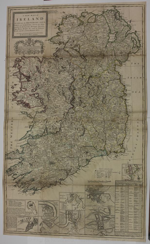 map / A New Map of Ireland, 1714
Map of Ireland, 18th century.
Titled ‘A New Map of Ireland’, divided into its Provinces, Counties and Baronies, wherein are distinguished the Bishopricks, Borroughs, Barracks, Bogs, Passes, Bridges & etc, with the Principal Roads, and the common reputed miles. According to the newest and most exact observations by Herman Moll, Geographer. Wth crest – To His Grace Charles Duke of Shrewsbury, Lord High Treasurer of Great Britain, Lord Chamberlain of His Majesty’s Household, Lord Lieutenant General and General Governor of Ireland, Knight of the Most Noble Order of the Garter etc. This map is most humbly dedicated by Your Grace’s most humble servant H. Moll, Geographer, 1714. Includes detail maps of the Giants Causeway, the Isle of St. Patricks Purgatory in the county of Dunnagall (Donegal), Waterford, Galway, The harbour of Kinsale, Limerick, Dublin and Cork.
Map has all the improvement of Henry Pratt viz the Roads, Computed miles from town to town etc.
Colour. Numbered in corner 13;
A New Map of Ireland, 1714
Object Number:
HH:2013.397 (temp)
Institution:
NMI
Date:
1714
Creator:
Moll, Herman
Place of production:
Great Britain
Collections:
Subjects: