map / The Times War Maps, WWI
 map / The Times War Maps, WWI
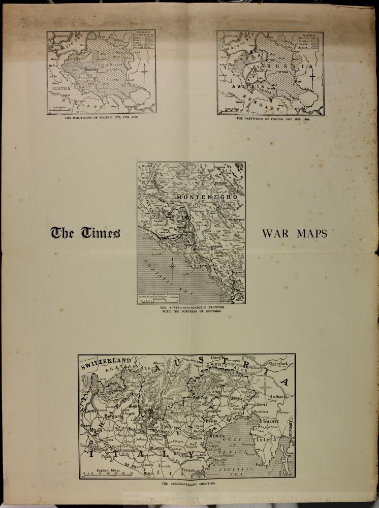
Map, The Times War Maps - four maps on one sheet - The Partitions of Poland 1772, 1793, 1795. The Partitions of Poland 1807, 1815, 1846. The Austro-Montenegrin Frontier with the Fortress of Cattaro. The Austro-Italian Frontier. One of nine maps published by The Times of London. Belonging to Captain Richard Burke of the Royal Irish Regiment, WWI.;
The Times War Maps, WWI
Object Number:
HA:2011.1.8.4.2
Institution:
NMI
Date:
1914
Creator:
Place of production:
England
Collections:
Subjects: