map / The Times Map of the North Sea, WWI
 map / The Times Map of the North Sea, WWI
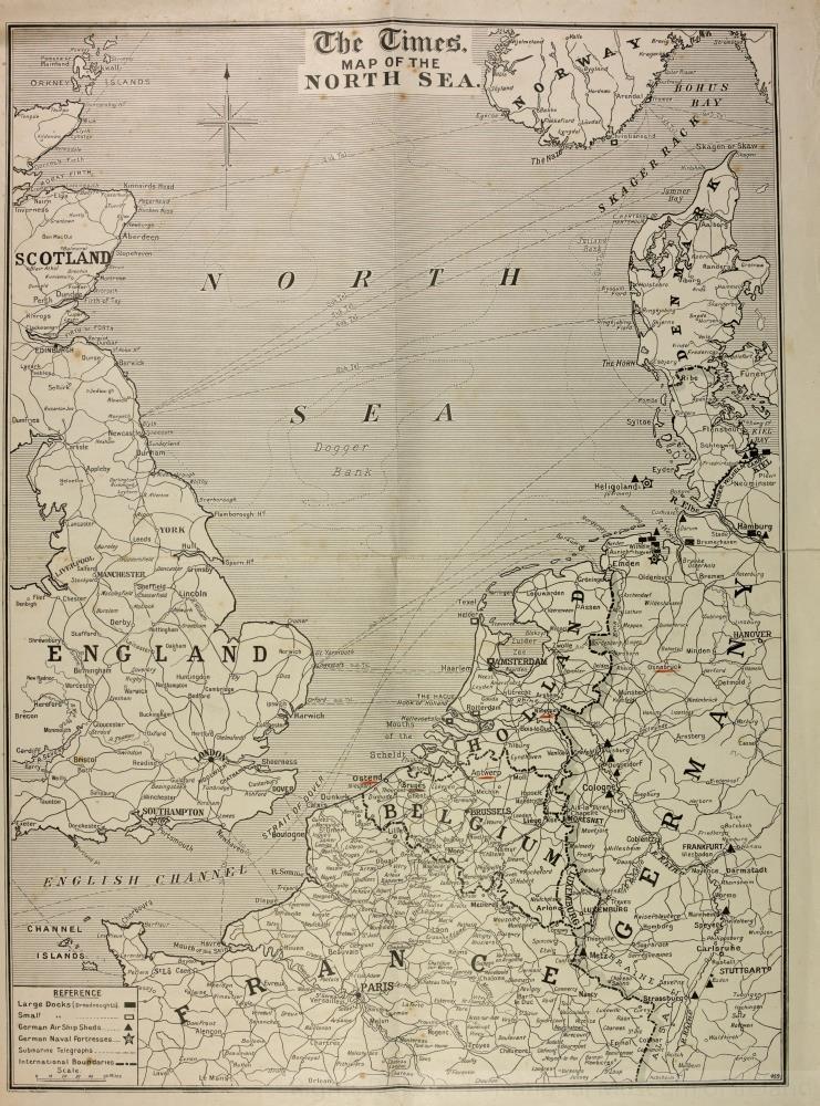
Map, The Times Map of the North Sea. Showing large docks (dreadnoughts), small docks, German airship sheds, German naval fortresses, submarine telegraphs and international boundaries. Cities of Bruges, Ostend, Nimegue, Osnabruck and Antwerp underlined in red by Burke. One of nine maps published by The Times of London. Belonging to Captain Richard Burke of the Royal Irish Regiment, WWI.;
The Times Map of the North Sea, WWI
Object Number:
HA:2011.1.8.4.6
Institution:
NMI
Date:
1914
Creator:
Place of production:
England
Collections:
Subjects: