map / Dublin, Sheet 18, 1838
 map / Dublin, Sheet 18, 1838
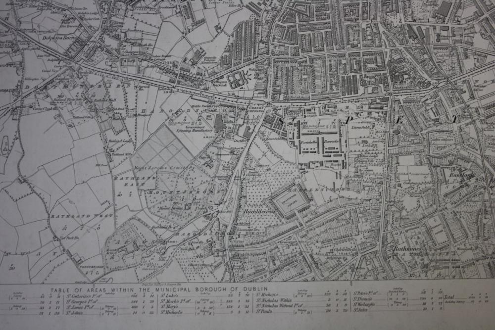
Ordnance Survey map of the city of Dublin, Sheet 18. A table of areas within the Municipal Borough of Dublin is listed underneath the map, and the names of the areas are printed. Printed in the lower left hand corner of the map is “Surveyed in 1837 by Captain Bordes & Lieutenants Tucker, James and Bennett, R.E. & Engraved in 1838 under the direction of Captain Larcom, R.E. AT THE ORDNANCE SURVEY OFFICE, PHOENIX PARK, by A. Chisholm & Sergeant West, the ornament by G. Mc Coy, the Writing by H. Grandison. Colonel Colby F.R.S.I. & F. M.R.I.A. &c. Superintendent”.;
Dublin, Sheet 18, 1838
Object Number:
HH:2013.408
Institution:
NMI
Date:
1838
Creator:
Ordnance Survey Office
Place of production:
Ireland
Collections: