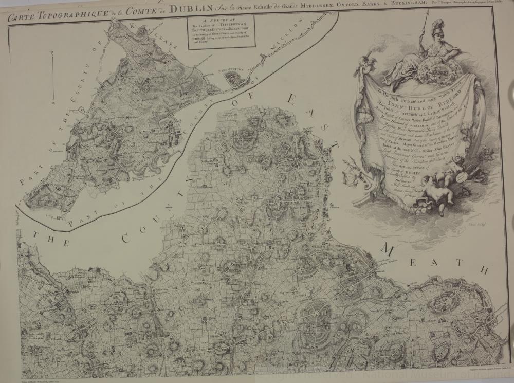
map / An Actual Survey of the County of Dublin, 1760
 map / An Actual Survey of the County of Dublin, 1760
 map / An Actual Survey of the County of Dublin, 1760
 map / An Actual Survey of the County of Dublin, 1760
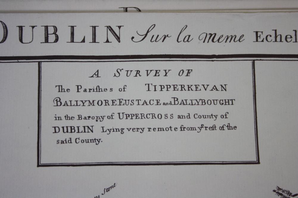
Map, showing the County of East Meath and part of the County of Kildare. Numbered C1.
Part of An Actual Survey of the County of Dublin, on the same scale as those of Middlesex, Oxford, Barks and Buckinghamshires, by John Rocque, 1760.
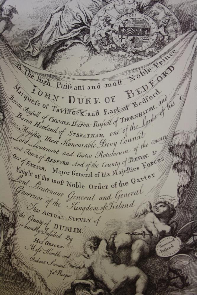
To the High Puissant and Most Noble Prince John Duke of Bedford, Marquis of Tavistock and Earl of Bedford. Baron Russell of Chenies, Baron Russell of Thornhaugh and Baron Howland of Streatham, One of the Lords of His Majesties Most Honourable Privy Council, Lord Lieutenant and Custos Rotulorum of the County and Town of Bedford, and the County of Devon & City of Exeter, Major General of His Majesties Forces, Knight of the Most Noble Order of the Garter, Lord Lieutenant General and General Governor of the Kingdom of Ireland.
This Actual Survey of the County of Dublin is most humbly inscribed by His Graces most dutiful and most obedient humble servant John Rocque.
Illustration engraved by J. Duron.
One of a set of four maps of Dublin and the environs, (C1 to C4), 18th century. A later reproduction.
Published by Harry Margary, Lympne Casgtle, Kent.
Printed by Headley Brothers Ltd, Ashford, Kent.;
An Actual Survey of the County of Dublin, 1760
Object Number:
HH:2013.392.2.1 (temp)
Institution:
NMI
Date:
1760
Creator:
Rocque, John
Place of production:
England
Collections:
Subjects: