map / An Exact Survey of the City and Suburbs of Dublin, 1756
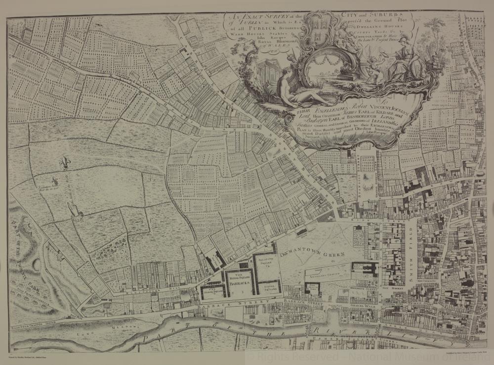 map / An Exact Survey of the City and Suburbs of Dublin, 1756
 map / An Exact Survey of the City and Suburbs of Dublin, 1756
Map, Dublin city, showing Oxmantown Green, Smithfield and The Royal Barracks as the centre. Numbered T1.
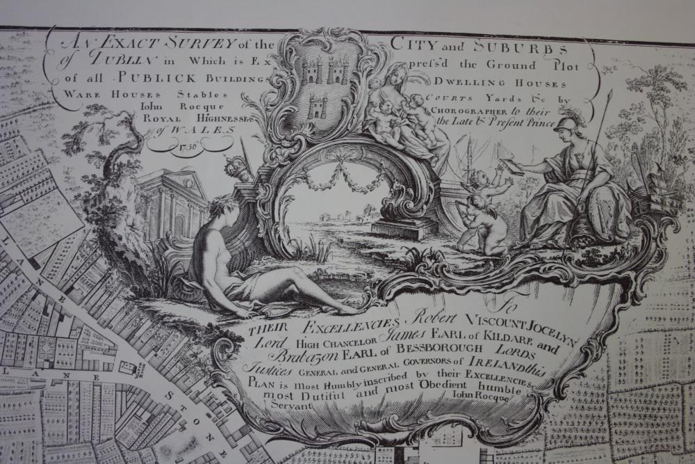
Part of An Exact Survey of the City and Suburbs of Dublin. In which is expressed the ground plot of all publick buildings, dwelling houses, ware houses, stables, courts yards etc, by John Rocque, Chorographer to Their Royal Highnesses the Late and Present Prince of Wales, 1756.
To Their Excellencies Robert Viscount Jocelyn, Lord High Chancelor James Earl of Kildare, and Brabazon Ealr of Bessborough, Lords Justices General and General Governors of Ireland this Plan is most humbly inscribed by Their Excellencies most dutiful and most obedient humble servant John Rocque.
One of a set of four maps of Dublin and the environs (T1 to T4), 18th century. A later reproduction.
Published by Harry Margary, Lympne Casgtle, Kent.
Printed by Headley Brothers Ltd, Ashford, Kent.;
An Exact Survey of the City and Suburbs of Dublin, 1756
Object Number:
HH:2013.392.1.1 (temp)
Institution:
NMI
Date:
1756
Creator:
Rocque, John
Place of production:
England
Collections:
Subjects: