Historical Collections Online
Search our Historical Collections Online, a sample of 10,000 artefacts from the National Museum of Ireland’s Historical, Military and Easter Week Collections, published as part of the Decade of Commemorations.
map / Cork (Fermoy) Sheet XVII 12, 1905
Ordnance Survey map of Cork (Fermoy) Sheet XVII 12. Showing the townlands of Newtown, Garryhintoge and part of Carkerbeg. Also showing field boundaries, houses and roads. Published by the Director General at the Ordnance Survey Office, Phoenix Park, Dublin, 1905.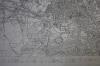
map / Dublin, Sheet 18, 1838
Ordnance Survey map of the city of Dublin, Sheet 18. A table of areas within the Municipal Borough of Dublin is listed underneath the map, and the names of the areas are printed. Printed in the lower left hand corner of the map is “Surveyed in 1837 by Captain Bordes & Lieutenants Tucker, James and...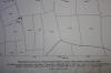
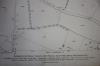
map / Cork (Fermoy) Sheet XVII 8
Ordnance Survey map of Cork (Fermoy) Sheet XVII 8. Showing the townlands of Skahanagh Beg, Castlepook South, Skahanagh More, Ballinree and part of Ballyshane. Also showing field boundaries, houses and roads. Published by the Director General at the Ordnance Survey Office, Phoenix Park, Dublin, 1905.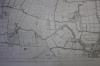
map / Cork Sheet 17, 1844
Ordnance Survey map of Cork Sheet 17. Showing various town lands and towns including Buttevant and Doneraile. Also showing field boundaries, houses and roads. Printed below the map “Surveyed in 1841 by Major Waters & Lieutenant Stace, R.E. & Engraved in 1844 under the direction of Captain Larcom,...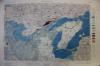
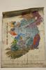
map / Geological Survey of Ireland (Navan) Sheet 91
A colour map of the Geological Survey of Ireland (Navan) Sheet 91.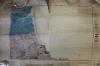
map / Geological Survey of Ireland (Drogheda) Sheet 92
Colour map of the Geological Survey of Ireland (Drogheda) Sheet 92.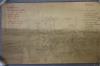
drawing / Drogheda
A pencil drawing of a map of part of Drogheda. Showing the street layout and places of interest marked in red pen. Drawn on the back of a piece of headed paper from the Department of Education, National Museum of Ireland, Kildare St., Dublin. Possibly the work of Dr Gerard Hayes McCoy.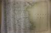
map / Louth, Cavan, Meath, Westmeath, Sheet 8
Ordnance Survey map of Ireland, Sheet 8, showing County Louth and parts of counties Cavan, Meath and Westmeath.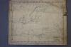
map / Europe
Map of Europe, scale of English miles, natural scale 1:21,5000.000. English. Published in London by G.W. Bacon & Co., Ltd., Norwich Street, Fetter Lane,E.C. 4.
map / Hill of Tara, 1911
Ordnance Survey map, section, showing the Hill of Tara and surrounding area. 2300 scale. Traced from the original manuscript plans XXXI 16 XXXVII 4. Ordnance Survey Office, 1911.
map / Drumcondra, Dublin
Ordnance Survey map, main section, showing the Drumcondra area of Dublin. Ordnance Survey Office. Sheet XVIII 6.
map / Glasnevin, Dublin
Ordnance Survey map, three sections, showing the Glasnevin area of Dublin. Ordnance Survey Office. Sheet XVIII 6.
reproduction / Battle of the Boyne
Photographic reporduction of the Plan of the Battle of the Boyne. NMI produced.
map / Royal Dublin Society, 1851
Layout of the Royal Dublin Society buildings and grounds. Title: Map of the Lawn and Premises of the Royal Dublin Society, (illegible) 1851.
map / Dundalk, 1907
Ordnance Survey map of Louth (Lower Dundalk). Sheet IV.16. A single house has been circled in pencil and inscribed "Mr. McDermott's house". Published by the Director General at the Ordnance Survey Office, Phoenix Park, Dublin 1909. Surveyed in 1907, re-printed in 1925. (presented to Mr. L.S.Gogan,...
map / Donegal, 1906
Ordnance Survey map of Donegal. Sheet 62. 1906 (Second Edition).