Historical Collections Online
Search our Historical Collections Online, a sample of 10,000 artefacts from the National Museum of Ireland’s Historical, Military and Easter Week Collections, published as part of the Decade of Commemorations.
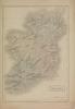
map / Ireland South Part, 1831
Map of Ireland, early 19th century. One of two maps, titled ‘Ireland South Part’. Published by Chapman and Hall, 186 Strand, London, March 1831. Engraved by Sidney Hall. Numbered in corner 49. Coloured.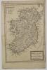
map / Ireland Divided into its Provinces and Counties
Map of Ireland, possibly 17th or 18th century. Titled ‘Ireland Divided into its Provinces and Counties &c. By H. Moll, Geographer’. Showing Archbishopricks, Bishopricks and Universities. Numbered in corner 14.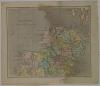
map / Ireland, North, 1808
Map of Ireland, early 19th century. Titled ‘Ireland’. (North) In two parts, North and South (Plates XLIV and XLV). Published by R. Phillips, Bridge Street, Blackfriars, London, 1 January 1808. Drawn and engraved by Cooper. Numbered in corner 39. Coloured.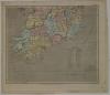
map / Ireland, South, 1808
Map of Ireland, early 19th century. Titled ‘Ireland’. (South) In two parts, North and South (Plates XLIV and XLV). Published by R. Phillips, Bridge Street, Blackfriars, London, 1 January 1808. Drawn and engraved by Cooper. Numbered in corner 39. Coloured.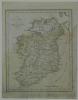
map / A New Map of Ireland, 1769
Map of Ireland, 18th or early 19th century. Titled ‘A New Map of Ireland’. Engraved by J. Cary. (probably London). With handwritten note reading ‘Illustrating the invasion of 1769’. Numbered in corner 22.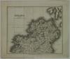
map / Ireland, North, 1824
Map of Ireland, early 19th century. Titled ‘Ireland’. In two parts, North and South. Plate XLIV (North). Published by G. & W.B. Whittaker, 13 Ave Maria Lane, 1824. Numbered in corner 48.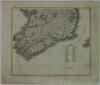
map / Ireland, South, 1824
Map of Ireland, early 19th century. Titled ‘Ireland’. In two parts, North and South. Plate XLV (South). Published by G. & W.B. Whittaker, 13 Ave Maria Lane, 1824. Numbered in corner 48.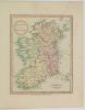
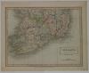
map / The Kingdom of Ireland, 1801
Map of Ireland, 19th century. Titled ‘The Kingdom of Ireland’. Published by Robert Laurie and James Whittle, 53 Fleet Street, London, 1 October 1801. Colour. Numbered in corner 36.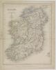
map / Ireland, Gilbert’s Modern Atlas
Map of Ireland, early 19th century. Titled ‘Ireland’. Gilbert’s Modern Atlas. Published for the proprietor by Grattan and Gilbert, map agents by appointment to the Honourable the Board of Ordnance, 51 Paternoster Row. Drawn and engraved by J. Archer of Pentonville, London. Province borders...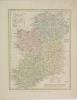
map / Ireland As Represented in the Imperial Parliament, 1814
Map of Ireland, early 19th century. Titled ‘Ireland As Represented in the Imperial Parliament. Contains 4 Provinces, 4 Archbishops, 18 Bishops, 33 Episcopal Sees’. Engraved by J. Archer. Published by Robert Wilkinson of 58 Cornhill, London, 5 September 1814. Colour. Numbered in corner 42.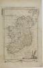
map / A New and Correct Map of Ireland from the Latest Surveys of the Kingdom, 1782
Map of Ireland, late 18th to early 19th century. Titled ‘A New and Correct Map of Ireland from the Latest Surveys of the Kingdom’. Engraved for Millar’s New Complete and Universal System of Geography. (Originally published in London by Alex Hogg, 1782). Numbered in corner 19.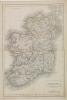
map / Ireland
Map of Ireland, 19th century. Titled ‘Ireland’. Engraved by Sidney Hall. Published by Chapman and Hall, 193 Picadilly, London. With railway lines and stations marked. Coloured province borders. Numbered in corner 62.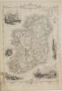
map / Ireland
Map of Ireland, early 19th century. Titled ‘Ireland’. With decorative shamrock borders, with harp on bottom edge, and illustrations of Irish scenes around the sides. Illustrations by J. Marchant, and engraved by J. Rogers. The map drawn and engraved by J. Rapkin. Published by J. and F. Tallis,...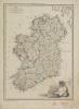
map / Irlande
Map of Ireland, early 19th century. Titled ‘Irlande’. Engraved by J.B. Tardieu of 9 Rue Poupee, Paris. Drawn by Giralden. Coloured province borders. Numbered in corner 47.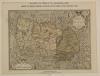
map / Ireland at the period of the Elizabethan Wars
Map of Ireland, 19th century. Titled ‘Eryn Hiberniae Britannicae Insvlae, Nova Descriptio’. Reproduction of an Elizabethan period map of Ireland, published by W.B. Kelly, 4 Ormond Quay, and 8 Grafton Street, Dublin, 1875. Morrison and Co., photo lithograph, Dublin. Ireland at the period of the...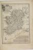
map / A New and Accurate Map of Ireland
Map of Ireland, late 18th or early 19th century. Titled ‘A New and Accurate Map of Ireland, laid down by the best Authorities extant, and regulated by Astromon Observat, by Eman Bowen’. Text beneath reads The late Ingenious Mr William Doyle, Hydrographer, having at the request and chiefly at the...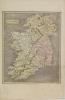
map / Ireland
Map of Ireland, early 19th century. Titled ‘Ireland’. Engraved by James Wallis. Published by S.A. Oddy, 20 Warwick Lane, London. Colour. Numbered in corner 29.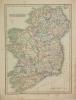
map / Ireland
Map of Ireland, early 19th century. Titled ‘Ireland’. Engraved by J. Bye. Published by C. Smith, Mapseller at 172 Strand, London, 6 January 1808. Colour. Numbered in corner 38.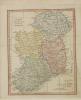
map / A New Map of Ireland from the Best Authorities, 1794
Map of Ireland, late 18th century. Titled ‘A New Map of Ireland from the Best Authorities’. Published by Robert Wilkinson, 58 Cornhill, London, 1 January 1794. Colour. Numbered in corner 31.